UAV survey in Curvature Carpathians – July
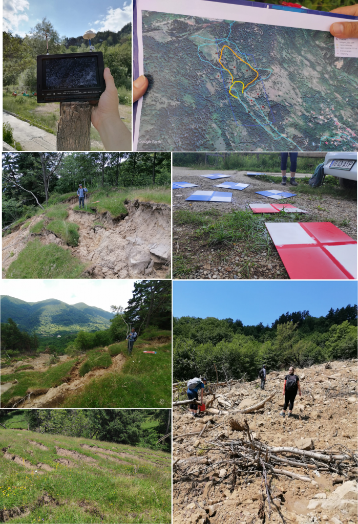
In 9 and 10 July, part of the UB team went to the recently-produced landslide in Bâsca Rozilei village, Buzău county, for supplementary observation and a UAV survey of the site. The resulting aerial photographs cover 0,98 square km, enclosing the body of the landslide, an intermediate collapsed sector and a secondary upper-hill scarp. The resulting orthophotoplan shows the ground morphological particularities that resulted from the movement. This enables mapping the specific sectors and better estimate the volume of the landslide and also contributes to the analysis of ancient landslides morphology in the area. UAV surveys in this study site are part of WP2, Task 2.1 Remote sensing and in-situ topography. Many thanks to our volunteer students Sabina Calisevici and George Boeriu, who were more than supportive!