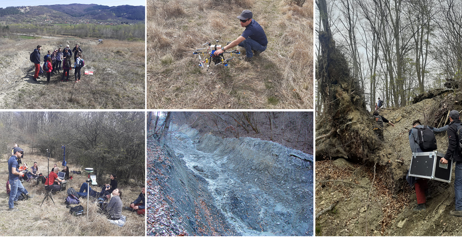
UAV flight over Chirlești earth flow – Curvature Subcarpathians
In April 14, part of UB team went for a UAV survey over Chirlești earth flow in the Curvature Subcarpathians, on the right bank of Buzău River. Two flights were made to cover the upper sector and the entire surface of the mudflow. The purpose was to obtain a digital elevation model in order to use it for building a run-out model of this flow. Further one, the run-out model will be analyzed in comparison with the one of the debris flow at Siriu dam, surveyed by UiO in September, trying to establish potential hazardous responses of these two different types of mass movements. This contributes to Objectives 2 and 3 of the project, Recent to present response of landforms and geo-hazards to climate trends and Predicting future changes in landforms dynamics and hazard-related phenomena, respectively. We appreciated the help of the group of geomorphology-passionate students from the Faculty of Geography at UB who actively participated to the one-day fieldtrip!